
Cartography
Intern and Student
Below include maps I have created, including my internship with NPS and from my classes as a GIS student. Feel free to expand on each map for additional information.
ArcGIS StoryMaps
Deforestation and Displacement in
Argentina’s Gran Chaco
From my final project in my Geovisualization class at GWU.

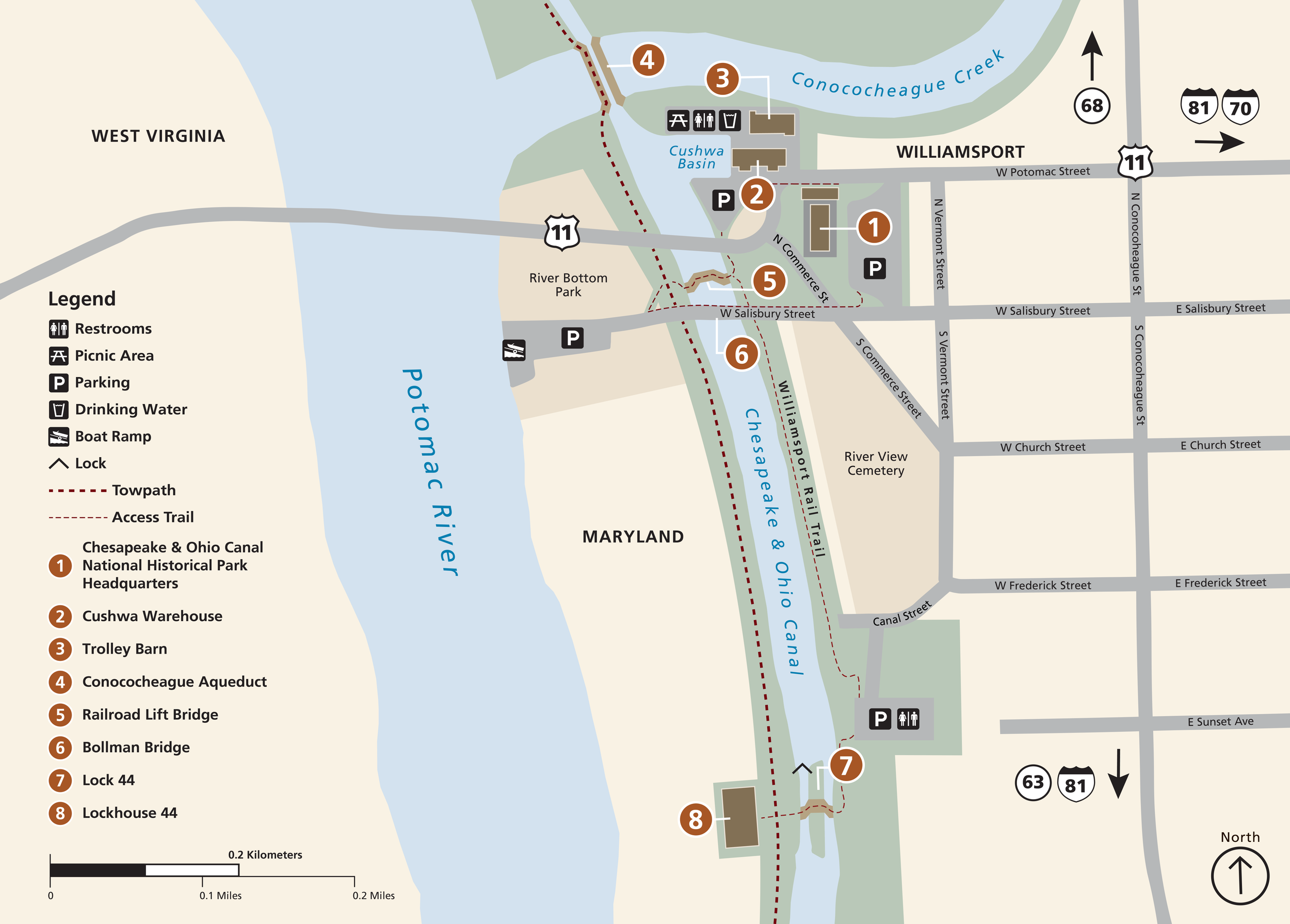
Map of Williamsport, MD, for the park's Visitor Center. Click for website!

Proposed infographic for Ford Mine Trail information.

Thematic map from my final project on the Gran Chaco. Click for StoryMaps!

Infographic for my final project on the Gran Chaco. Click for StoryMaps!

Turf map, digitized from drawing by hand. Click for a step by step process!

Sardoba Dam Failure from my GIS II class. Click for a look at the report and methodology.

Mapping food deserts in D.C. from my GIS II class. Click for a look at the report and methodology.

Mapping food deserts in D.C. from my GIS II class. Click for a look at the report and methodology.

Habitat modeling from my GIS II class.

Remote sensed Lake Mead depletion from my GIS II class.

Tombstone Georeferencing from my GIS II class.
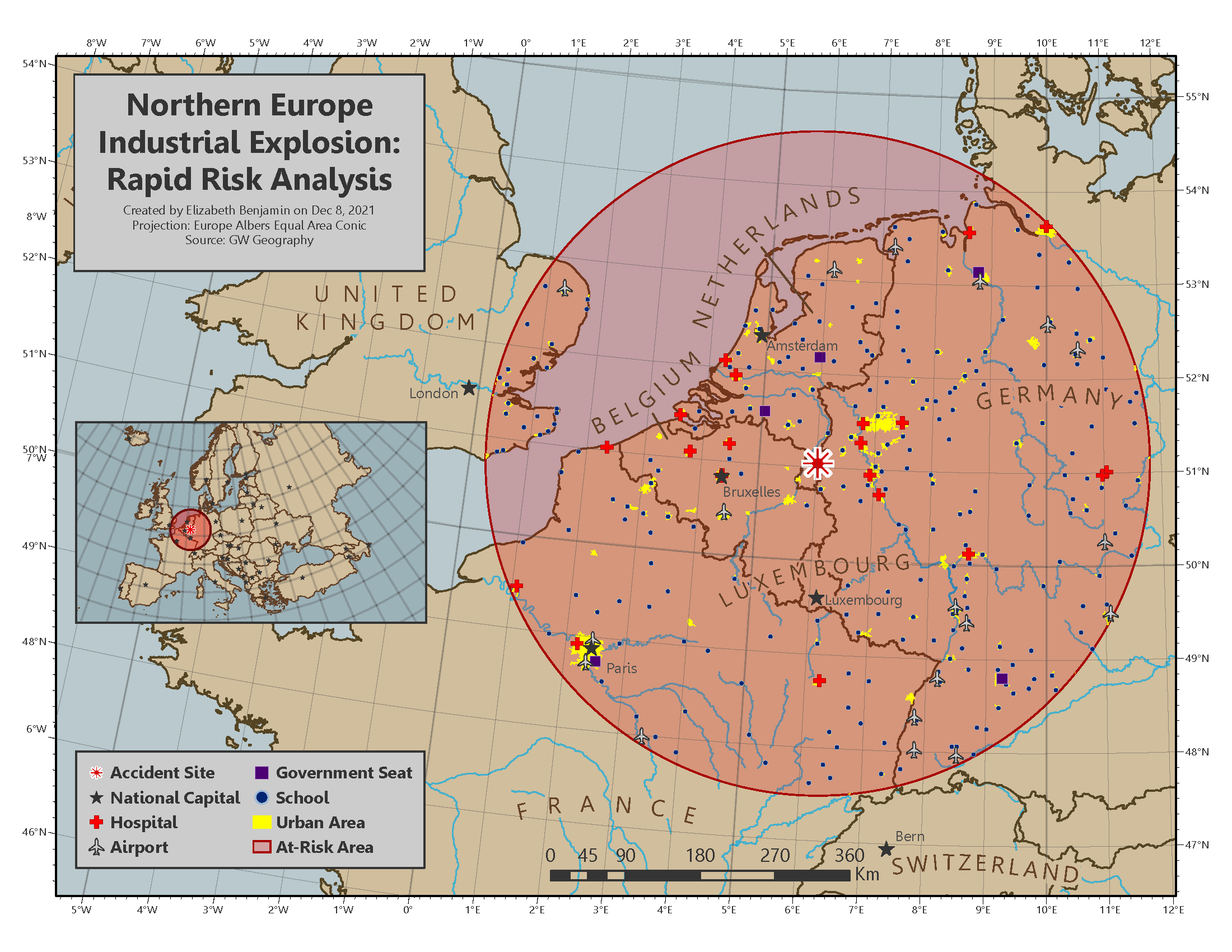
Industrial Explosion Rapid Risk Analysis from my GIS I class.

Nepal Earthquakes from my GIS I class.